
Lancaster Neighbor Record Sources
Public sources answer different block questions. The map establishes which parcels share a boundary. Assessment information records the assessed owner and fields carried on that account. A Recorder instrument documents a legal transaction. Historical directories can show a dated listing at an address. None of those sources creates a verified roster of Lancaster neighbors, so keep the source and the claim together in a simple parcel ledger.
| Source | What It Shows About a Block | Access |
|---|---|---|
| LanCo View 2.0 and wEdge | Adjacent parcel shapes, account context, deed reference, assessed owner, and recorded mailing field | Free public map and assessment portal; owner field is not an occupant list. |
| Recorder and Archives | Legal parties and transfer history for a particular neighboring parcel | Web index begins in 1981; earlier deeds use microfilm, Archives, or other collections. |
| City directories | Historical street listings, vacancies, and address clues | Historical and incomplete, with the documented digitized run from 1843 through 1922. |
| Street or Walking List | Specified registered-voter administrative fields by street | Signed electronic request, $20, and strict use and nonpublication rules. |
| City neighborhood groups | Civic group names and a public engagement route | Voluntary participation, not a public membership directory. |
The chief distinction is owner versus occupant. A parcel record can support the phrase “assessed owner as recorded,” while a deed supports the phrase “party to this transfer.” Neither fact confirms who is currently present at the property.
Lancaster Parcel Adjacency
LanCo View 2.0 is the map-first starting point for a single Lancaster block. Search the known address or parcel, keep parcel and road layers visible, and inspect only the polygons that meet the starting parcel. The County describes the viewer as a free property-search application with parcel information, acreage, dimensions, deed reference, aerial imagery, roads, and other map context. Its purpose is spatial: it tells you which land edges touch.
Use direct parcel clicks for a small block. The researched current LanCo View materials did not verify a buffer, radius, or select-by-distance tool, so do not assume one exists. The legacy public GIS interface includes measurement functions, but a boundary relationship should come from visible adjoining polygons. Record each parcel identifier and its relation, such as left, right, rear, or corner, before opening another system.
The map hands off to two other County systems. Use the assessment application for assessed value and account fields, then use the Recorder route for deed information. LanCo View is not a legal survey, and the County directs questions about value and deeds to those specific offices. Its separate LanCo View PLUS subscription adds advanced parcel, zoning, and data features, but a one-block check can begin with the free public viewer.
Mapping a Lancaster Block
The adjacent-parcel workflow keeps the Lancaster neighbors question narrow. It moves from one address to the few parcels that share an edge, then to the record that explains each parcel. The result is a documented block relationship, not a claim about private household membership.
- Locate the starting address or parcel in LanCo View 2.0 and write down the parcel or account identifier.
- Click only the adjoining parcel polygons and log each physical relation, including a rear or corner connection where shown.
- Open each account in Lancaster County Property Tax Inquiry for its site, assessment, owner, and mailing fields, keeping site and mailing addresses separate.
- Use the deed reference in the Recorder index to verify a legal transfer when that detail is needed, then stop at the immediate block boundary.
- Parcel
- A mapped unit of land identified by an account or parcel number in the County systems.
- Situs address
- The physical location of the land or building, which is separate from an owner's mailing field.
- Deed reference
- A document number or book-and-page pointer used to find the recorded transfer.
For a complete named-street chain rather than a single block, use the Lancaster By Street directory. Its address method is broader; the parcel walk here intentionally stays local.
Note: A physical parcel edge confirms adjacency on the map, not a personal relationship, shared household, or current presence at either address.
Lancaster Voter List Rules
Pennsylvania provides two separate voter channels. The public Find Voter Registration Status service is an individual's registration-status route, not an anonymous street browser. Formal list products are the official route for a qualified street-level request. The Public Information List, Street List, Walking List, and Full Voter Export differ in fields, but they are electronic request products rather than results that should be copied into a neighborhood list.
The Street List includes name, residential address, mailing address, party, and active or inactive status. The Walking List omits mailing address. The request form requires identifying information and a signed affirmation. Under 25 Pa.C.S. §§1207 and 1404, use is limited, and the related SURE regulations bar Internet publication. The $20 charge and the rules apply even when the request concerns one Lancaster block.
Lancaster County Voter Registration is the practical local fallback for a request question. The County directory lists the office at 717-299-8293 in the Government Center at 150 N. Queen Street. A voter status can change after a move, a name or party update, a confirmation response, or normal election maintenance. It remains an administrative status, not proof of where a person physically sleeps.
Lancaster Neighborhood Group Contacts
The City's community layer is for civic participation, not name matching. Lancaster City Neighborhood Engagement lists established groups and programs such as block-party guidance, Love Your Block, Neighborhood Leaders Academy, and an Adopt-A-Block map. It does not publish a public resident roster. Use a group's public channel to learn about its work or participate voluntarily, not to infer who belongs to it.
| City-listed Lancaster groups | Public role |
|---|---|
| Chestnut Hill Neighbors, College Park Climate Action Neighborhood, and East Side Neighbors | Established civic groups listed through the City engagement program. |
| Musser Park Civic Association, Neighbors of Old Town, Northeast Neighbors United, and Southeast UNITY | Public neighborhood-engagement contacts, not verified membership records. |
| Mussertown Neighbors, SoWe, and West Lancaster Jewels | Local civic participation routes that remain voluntary and privacy bounded. |
The City lists Neighborhood Engagement at 120 N. Duke Street and 717-291-4711. That office can point people toward its listed programs, but it does not convert a civic group into a block directory.
LancasterHistory, alumni groups, congregations, civic clubs, veteran groups, and obituary publishers may hold voluntary or historical material, but the documented research did not find one comprehensive public online roster. Ask a particular group about its own public contact route instead of presuming access to its member list.
Lancaster Block History
Historic sources can explain a block without answering a current-neighbor question. Lancaster's original 1730 plan used James Hamilton lots, eight per block, with rear alleys. That regular pattern helps connect old legal descriptions, lots, corners, and surrounding streets to a modern parcel. Early sources may name a corner instead of a familiar street number, so map, deed bounds, lot, and alley references should be compared together.
The documented map and atlas sequence held through LancasterHistory includes 1842, 1858, 1864, 1874, 1875, 1886, and 1899. Pair a map with a dated directory, deed, permit, or tax record. An address appearing in one year and absent in another is a research lead, not proof of a construction date or a complete household list.
Historical city directories add street-organized entries and occasional vacancy clues. Read the few entries beside a target address, then check the same names in the alphabetical portion and compare another year. A directory describes a dated listing, while a deed describes a transfer. Keeping those labels separate avoids turning a historical block clue into a current-neighbor claim.
Lancaster Report Access
Government reports have a different access path from parcel records. The Lancaster City Police Records Unit publishes the official request route for eligible local reports. A report request does not establish the people who live around an address, and it should not be used as a substitute for the parcel-by-parcel method.
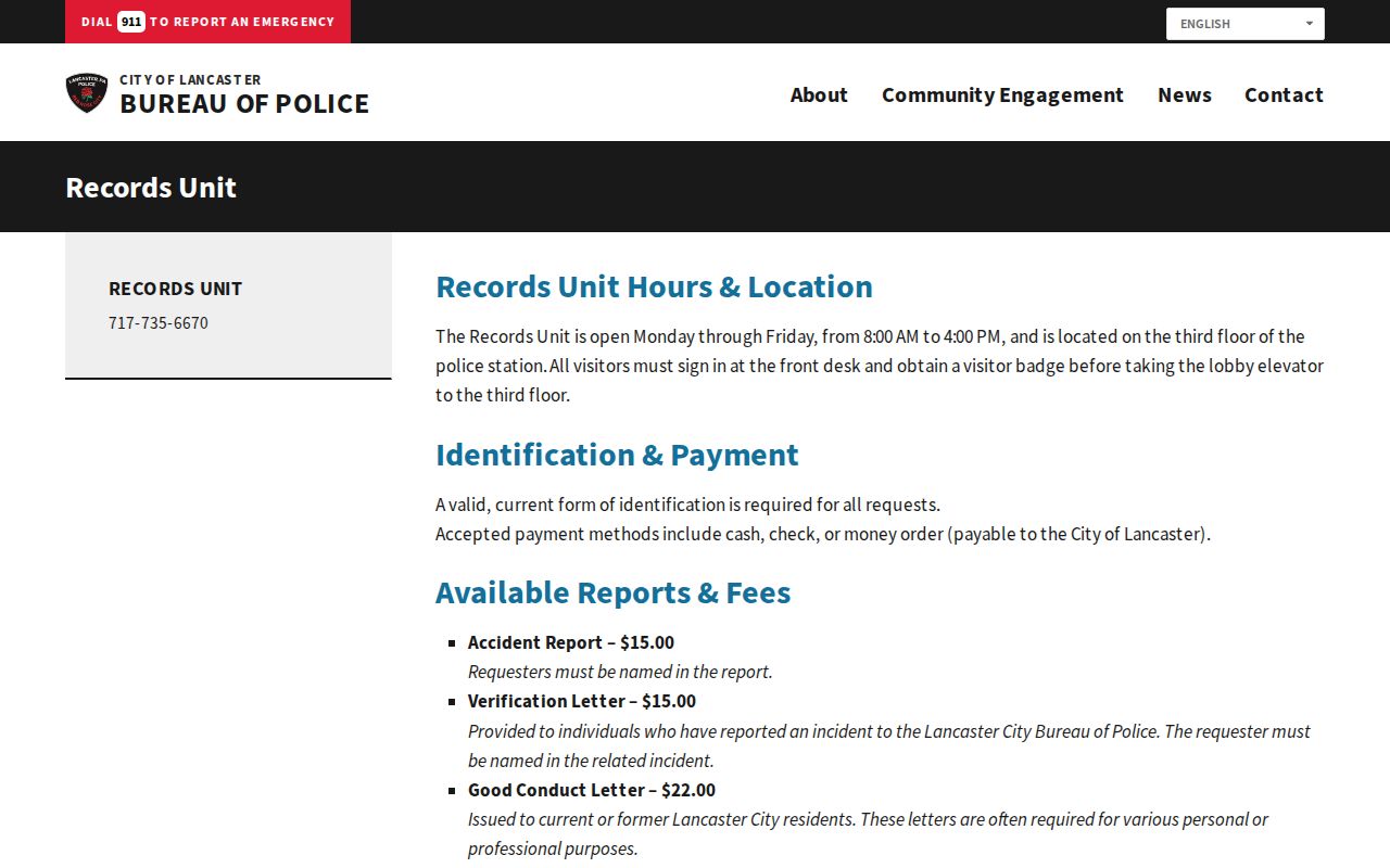
The separate Records Unit route illustrates why the custodian matters. Confirm a report or record with the office that maintains it, then keep it distinct from property, deed, or civic information.
Lancaster Neighbor Tool Comparison
Official records and unverified commercial neighbor lists serve very different purposes. The official route has a known custodian, a defined record scope, and limits that can be checked. An unverified list may merge similar names, retain an old address, omit corrections, or blur owner information with assumptions about a household. Use a parcel number, deed reference, or dated directory entry to test any claim that matters.
| Source type | Useful evidence | Boundary |
|---|---|---|
| County parcel and assessment records | Parcel, site, assessed owner, and recorded account context | Does not prove who is present at the address. |
| Recorder deed record | Parties, legal description, recording date, and prior reference | Shows a transfer, not a current-neighbor roster. |
| Unverified commercial neighbor list | Possible lead requiring independent confirmation | May be stale, merged, incomplete, or unclear about its source. |
Use the official source first, save the search date and reference, and compare one independent field before relying on a result. A plainly recorded limitation is better than a list that looks complete but cannot identify its custodian, date, or method.
Lancaster Neighbor Privacy Limits
Public access to one record does not create permission to collect or republish personal information without limits. Pennsylvania's Right-to-Know Law yields to exemptions and other laws. Court matters can be sealed or limited, and an address may be redacted or protected. The assessment owner field is not a household record. Voter-list data has strict request, use, and publication rules. A missing entry can be a legal protection, an incomplete record, or a simple change in the underlying data.
Lawful use. Use Lancaster neighbor records for personal, lawful civic research and block awareness. Do not use any record to follow, stalk, harass, intimidate, pressure, or expose another person.
Pennsylvania's Address Confidentiality Program gives qualifying participants a substitute mailing address for many public systems. It is a safety feature, not a gap to overcome. If an official entry appears wrong, contact the Assessment office, Recorder, voter-registration office, court clerk, or other custodian responsible for that specific record.